


|
|
|
|
|
|
|
Namma Mangalore |
|
|

|
Your guide to exploring thIS beautiful city |
|
Mangalore, also known as Mangalooru, Mangalapura, Maikala, Kudla, Kodial etc, is the chief port city of the Indian state of Karnataka. Bounded by the Arabian Sea and the Western Ghat mountain ranges, Mangalore is the administrative headquarters of the Dakshina Kannada (formerly South Canara) district in southwestern Karnataka.
Mangalore derives its name from the local Hindu deity Mangaladevi. It developed as a port on the Arabian Sea – remaining, to this day, a major port of India. Lying on the backwaters of the Netravati and Gurupura rivers, Mangalore is often used as a staging point for sea traffic along the Malabar Coast. The city has a tropical climate and lies on the path of the Arabian Sea branch of the South-West monsoons. Mangalore's port handles 75% of India's coffee exports and the bulk of the nation's cashew exports.
Mangalore was ruled by several major powers, including the Kadambas, Vijayanagar dynasty, Chalukyas, Rashtrakutas, Hoysalas, and the Portuguese. The city was a source of contention between the British and the Mysore rulers, Hyder Ali and Tippu Sultan. Eventually annexed by the British in 1799, Mangalore remained part of the Madras Presidency until India's independence in 1947. The city was unified with the state of Mysore (now called Karnataka) in 1956.
Mangalore is demographically diverse with several languages, including Tulu, Konkani, Kannada, and Beary commonly spoken and understood. The city's landscape is characterized by rolling hills, coconut palms, freshwater streams, and hard red-clay tiled-roof buildings. |
|
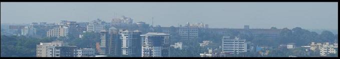
VIEW OF MANGALORE CITY AS SEEN FROM KADRI HILLS |


|
HOME |